
Roofers in Herne
12.3 road miles from Margate. Re-roofs, repairs, chimneys and lead for Herne houses, with the address checked against conservation areas and Article 4 maps before any price is written.
- Canterbury decidesHerne's planning applications are decided in Canterbury.
- Three protected areasHawe Farm, Herne Windmill and Herne conservation areas nearby.
- STG building controlSTG Building Control Partnership inspects.
Twelve Article 4 areas, three conservation areas and one Grade I church
Twelve directions
Canterbury's published list names twelve Article 4 areas near the centre, by address on Herne Street, Lower Herne Road and Canterbury Road.
Three areas
Hawe Farm, Herne Windmill and Herne are the conservation areas within about 0.75 km of the centre.
STG inspects
Building control for a Herne address is the STG partnership, which also serves Gravesham, Medway and Swale.
Herne and Broomfield parish, 8,765
Where Herne's records meet the roof survey
| Council | Canterbury City Council |
|---|---|
| Building control | STG Building Control Partnership |
| Scaffold and skip licences | Kent County Council |
| Conservation area | Hawe Farm; Herne Windmill; Herne |
| Population, 2021 | 8,765 (Herne and Broomfield parish) |
| From Margate | 12.3 road miles, about 19 min |
| Church of St Martin | Grade I, first listed 29 September 1951 |
| Colonial Cottage Sunnyside | Grade II, first listed 14 May 1976 |
| Chestnut Cottage Globe Cottage | Grade II, first listed 14 May 1976 |
| Article 4 areas near the centre | 12 |
The parish of Herne and Broomfield counted 8,765 residents at the 2021 Census, a figure that covers more than Herne itself, and the village centre holds a Grade I church and 22 listed entries within 500 metres.
Sources: ONS Census 2021, Canterbury City Council, Kent County Council, OSRM road routing.
Herne, twelve Article 4 areas
Twelve Article 4 areas, three conservation areas and a Grade I church shape a roof survey in Herne
Three chapters: the listed church and the conservation areas, the Article 4 addresses with Canterbury's planning lines, then the licences, rainfall and order of work.
Chapter 01 of 03
St Martin's church and three conservation areas in Herne
Herne is 12.3 road miles west of Margate, about 19 minutes by road, and three conservation areas lie within about 0.75 km of its centre: Hawe Farm, Herne Windmill and Herne. Canterbury City Council lists 97 conservation areas in total, so the opening check on any Herne address is which of them, if any, it falls in. The parish of Herne and Broomfield counted 8,765 usual residents at the 2021 Census, a figure that covers more than Herne itself. The checks that follow are made for each address in turn.
The Church of St Martin is listed Grade I (entry 1084972, first listed on 29 September 1951). Canterbury's World Heritage Site also names a St Martin's Church, but that one stands in Canterbury city, and Herne's church of the same dedication is a separate listed building with an entry of its own. Colonial Cottage Sunnyside (entry 1115129) and Chestnut Cottage Globe Cottage (entry 1336839) are both Grade II, each first listed on 14 May 1976. Historic England's list shows 22 listed entries within 500 metres of the centre.
A house with an entry of its own needs listed building consent where the work touches its character (section 7 of the 1990 Act), and Canterbury City Council decides the application. A listed house keeps its permitted development rights for roof work, with consent required on top of them. St Martin's is used for Church of England worship, so work to it follows the faculty system and not consent from the council. Neither route is quick to second-guess from the pavement, which is why the address comes first and the price second.
Whichever route applies, the roof is described slope by slope before it is priced, and the pictures go to you. Where one of the three conservation areas is in play, the survey records the ridge line, the chimney stacks, the verge detail and the covering as they stand, so an application can describe the roof as it is and as it will be. Replacement jobs on older houses are covered on our roof replacement and installation page, and the water side of the roofline, from gutters to fascias, is on guttering, soffits and fascias.
Chapter 02 of 03
Twelve Article 4 areas and the streets they name
Canterbury City Council's Article 4 areas, published on planning.data.gov.uk, include 12 close to Herne's centre. They are named by address: 7 on Herne Street (numbers 22, 24, 26, 28, 42, 44 and 46), 4 on Lower Herne Road (29, 37, 39 and White Cottage at 43) and 1 on Canterbury Road, Primrose Cottage. An Article 4 direction enables a council to withdraw specified permitted development rights across a defined area. Which rights each of these removes is for Canterbury City Council to state.
An address on those streets therefore gets a written enquiry to the council before we price: naming the property, asking whether a direction applies and what it covers. If the answer is yes, the application route is fixed first and the scaffold is booked after it; if no, the survey records that. Canterbury lists 97 conservation areas in all, and a street name alone is never taken as the answer.
| Road | Addresses listed |
|---|---|
| Herne Street | 7 |
| Lower Herne Road | 4 |
| Canterbury Road | 1 |
| All three roads | 12 |
Source: Canterbury City Council Article 4 dataset, on planning.data.gov.uk
Flats are the exception. Canterbury City Council treats flats and maisonettes as having no permitted development rights, so a flat whose roof will look different starts with a planning application, and managing agents should ask early. For a house, a change of covering is normally permitted development. If a new opening is on the list, the roof window planning permission guide has the conditions, so read it before any drawing is commissioned.
Building control for Herne goes through the STG Building Control Partnership, which Canterbury runs jointly with Swale, Medway and Gravesham from offices in Rochester, on 01634 331133. No Kent district publishes its own re-roofing percentage, so the Planning Portal test applies. It has two parts, met together: less than 25 per cent of the building envelope and less than 50 per cent of the roof. A Herne re-cover needs approval if the covering is 15 per cent or more heavier, or if it would behave in a fire in a way significantly unlike the old one. At survey each of these answers becomes a line on one sheet: conservation area or not, Article 4 or not, listing or not, flat or house, and the building control route. The sheet travels with the pictures, so the person pricing the work and the person on the roof read the same facts about this particular Herne roof.
Chapter 03 of 03
Scaffold licences, rainfall and the order of work
Kent County Council is the highway authority in Herne, and under section 169 of the Highways Act 1980 a scaffold that obstructs the highway needs its licence. Kent County Council expects the scaffolding firm to apply, so for a Herne job the scaffolders apply to Kent County Council and we confirm the dates with them. Kent County Council's scaffold permit costs £52 per week for 2026 to 2027, the notice is 5 working days, and public liability cover is required, at £5 million or above. A skip on the highway has a separate permit at £45 per week for the same year, and a skip may not be longer than 5 metres or wider than 2 metres.
Met Office averages for Manston, 1991 to 2020, put annual rainfall at 612.64 mm, spread over 110.05 days with 1 mm or more. They describe Manston and not Herne, but they give a scale for what a roof's drainage has to handle. A gutter needs a fall to carry that water to the downpipe: Brett Martin's guidance is 1 mm for every 600 mm of run, and BS EN 12056-3 covers the layout and calculation of roof drainage.
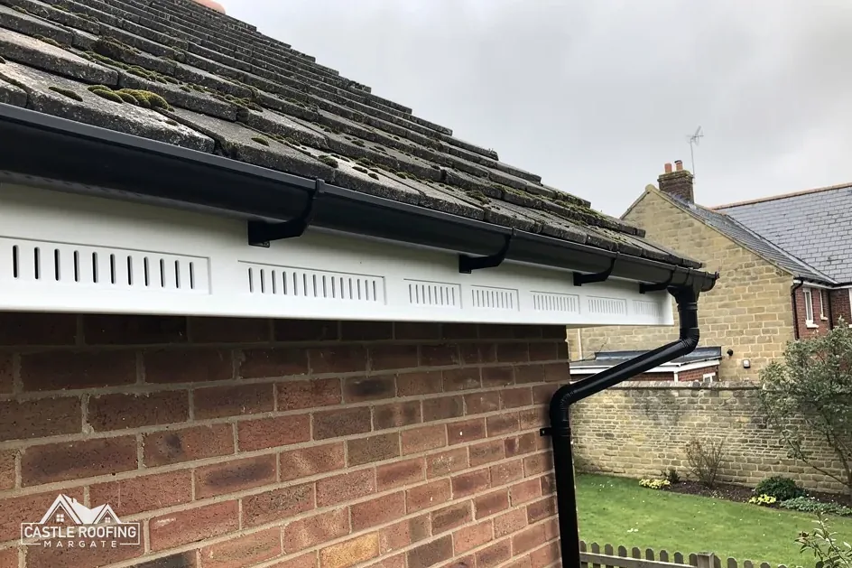
A bracket that has dropped or a joint that has settled can undo that fall over a short run, which is why a gutter that overflows in rain is measured along its length and not simply cleaned out and left. The same goes for fascias and soffits behind it, where a leak that began in the gutter shows up as soft or stained timber. A retailer, Plastic Centre, puts uPVC fascia boards at between 20 and 40 years, a typical range and not a promise, so the board behind a failing gutter is judged on its condition and not its age. The work is covered on guttering, soffits and fascias.
Once the paperwork is clear, the job runs in the order below, with a short update from us after each day's work. Bat roosts are fully protected by law, and the GOV.UK guidance on bats puts roof mending and renewal on the list of work that may disturb them; a sign of them in the loft stops the job until advice has been taken, which protects both the animals and the householder from an offence.
Checks before a Herne re-roof
Find the address
Conservation areas, the Article 4 list and any listing are looked up first.
Survey and pictures
Slopes, stacks, valleys and gutters are checked and you receive the pictures.
Ask the council
Canterbury confirms planning points and the STG partnership the building control route.
Licence, work, clear-up
Scaffolders apply to Kent County Council, work runs slope by slope and waste is removed.
10-Year workmanship guarantee. In writing
Around Herne
Broomfield, Herne Bay and Hersden around Herne
Herne answers to Canterbury City Council, as do Herne Bay, Broomfield, Hersden and Chestfield, so planning enquiries, Article 4 questions and the STG building control route follow the same path in all five.
Herne's Article 4 addresses, flats and St Martin's
Is my house one of the twelve Article 4 addresses in Herne?
Canterbury City Council's dataset names addresses on Herne Street, Lower Herne Road and Canterbury Road, including the even numbers 22, 24, 26 and 28 and 42, 44 and 46 Herne Street. If yours is among them, only the council can say which rights its direction removes. We send Canterbury the address in writing before pricing and pass the reply on to you.
Which of Herne's three conservation areas covers my street?
The national planning dataset names Hawe Farm, Herne Windmill and Herne, all within about 0.75 km of the centre. Their boundaries are held by Canterbury City Council, so a street name is a pointer and not a ruling, and two neighbours can sit on opposite sides of a line. We ask the council about your address before the price is written, and where the answer matters for the job the survey records it.
Who inspects a re-roof in Herne, and where is that team?
The STG Building Control Partnership, shared by Canterbury with three other Kent councils and based in Rochester; its inspectors can be reached on 01634 331133. It inspects the work and issues the approvals. You may instead appoint a registered building control approver; private building control existed before registration began on 6 April 2024.
Does a flat in Herne need planning permission to change its roof?
Canterbury treats flats and maisonettes as outside permitted development altogether, so a flat whose outside will look different needs planning permission. Works that do not materially affect a building's external appearance are not development at all, under the Town and Country Planning Act 1990. Which side of that line a roof falls on is a question for the council before work starts.
Does Canterbury's World Heritage Site, which includes a St Martin's Church, cover Herne's church?
No. UNESCO's 1988 inscription covers three parts, all in Canterbury city, and the Herne church is not one of them. The Church of St Martin in Herne is a separate Grade I listing, entry 1084972. Inside the World Heritage Site boundary dormers lose their permitted development, but that boundary is in Canterbury city and is not the planning position for a Herne house.
Start with the Herne survey
Send pictures or call, and we look before we price; the written total follows the survey.