
Roofers in Chartham
21.6 road miles from Margate. Chartham homeowners get a survey and photographs of their own roof first, then one written price, with the listed and scheduled records checked along the way.
- Canterbury decidesCanterbury City Council decides planning here.
- Village conservation areaChartham conservation area, near the village centre.
- STG building controlSTG handles building control for Canterbury.

A Grade I church, a scheduled dovecote and twenty-two listed entries
St Mary's
Chartham's church of St Mary, Grade I from 30 January 1967, is Anglican and in use, so it takes the faculty route.
The dovecote
Dovecote at Burnt House Farm is a scheduled monument within about 500 m of the centre; works need scheduled monument consent.
Three directions
Canterbury's data names Deanery Farm Cottages on Bolts Hill and Riverside Gatehouse; the council says what each direction covers.
Chartham, Canterbury district
Chartham's parish, planners and approvals
| Council | Canterbury City Council |
|---|---|
| Building control | STG Building Control Partnership |
| Scaffold and skip licences | Kent County Council |
| Conservation area | Chartham |
| Population, 2021 | 4,753 (Chartham parish) |
| From Margate | 21.6 road miles, about 35 min |
| Usual residents, 2021 Census | 4,753 |
| Listed entries within 500 m | 22, National Heritage List |
| Grade II, first listed 1980 | Riverview Cottage |
| Flood zone at the mapped centre | Zone 3, Environment Agency |
Chartham parish had 4,753 usual residents at the 2021 Census. Canterbury City Council is the planning authority and STG Building Control Partnership handles approvals.
Sources: ONS Census 2021, Canterbury City Council, Kent County Council, OSRM road routing.
Chartham, record by record
Chartham roofs, from the parish church and a scheduled dovecote to rainfall and road permits
Listed and scheduled buildings first, then the conservation area, Canterbury's Article 4 map and STG, then flood zone, rainfall and the Kent County Council permits behind a job.
Chapter 01 of 03
A Grade I church, a dovecote and twenty-two listed entries
Chartham sits 21.6 road miles to the south-west of Margate, about 35 minutes by road, and the parish carries a long heritage list, so a roof survey here starts with the list entries. Historic England's data shows 22 listed entries within 500 metres of the village centre. St Mary's church is Grade I, first listed on 30 January 1967 under entry 1100352. Riverview Cottage is Grade II, listed on 14 March 1980 under entry 1085691, and The Artichoke Inn is also Grade II, under entry 1085689.
A listed house needs listed building consent for works that affect its character, under section 7 of the Planning (Listed Buildings and Conservation Areas) Act 1990. On a Chartham cottage or inn that means the roof's covering, its ridge, which is the capping along the top, and its chimney stack, which is the brick chimney rising through it. Canterbury City Council decides the application. Its own page says you will need listed building consent for any changes which affect a building's character, and it is a plain test to apply to a roof.
The church is a different case. Because Anglican worship continues there, it is handled by the faculty system under the ecclesiastical exemption, not by listed building consent, so roof work there follows that church process. The dovecote is different again: Dovecote at Burnt House Farm is a scheduled monument within about 500 metres of the centre, entry 1018874, and damaging or altering a scheduled monument without authority is an offence under the Ancient Monuments and Archaeological Areas Act 1979. Works there need scheduled monument consent, a separate regime from listed building consent and from planning.
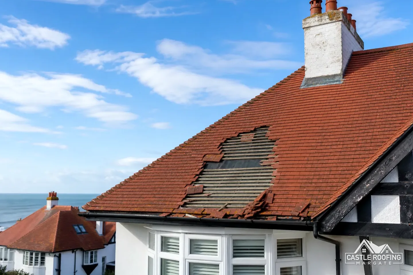
For everything else in the village, the answer starts with the address. We look up the list entry, survey the roof and send photographs before any price is set. On a listed roof the repair follows the roof: slates stay slates, clay tiles stay clay, and lead flashings, the strips of metal dressed over the joint where roof meets wall, are renewed in lead. Mortar flaunching, the bed that holds chimney pots, is redone to match. Our chimney repair and roof repair pages show how we scope small jobs, and the annotated photograph names the parts a surveyor points at first.
Chapter 02 of 03
One conservation area, three directions and STG's route
The national planning dataset places a conservation area named Chartham within about 0.75 km of the village centre. Canterbury City Council counts 97 conservation areas across its district, so the first question is which line your own street sits on, and the map answers it quickly. A conservation area is article 2(3) land under the General Permitted Development Order, and our roof window planning guide explains what that does to dormers and roof windows. A map lookup tells us whether your street is inside the line, and the council's planners can confirm the edge cases.
Canterbury's own Article 4 dataset lists three direction areas near the centre of Chartham, at 3 and 4 Deanery Farm Cottages on Bolts Hill and at Riverside Gatehouse, and the council says its map shows the areas covered by a direction. What a Canterbury direction removes is for the council to say, address by address. GOV.UK describes an Article 4 direction as a power for the local planning authority to withdraw named permitted development rights over a set area, and that definition leaves the rights to each notice. We put the question to Canterbury City Council with your full postal address, and the answer arrives before a specification is drawn up.
Checking a Chartham address
Map the address
Place it against the list, the scheduled monument and the conservation area.
Ask Canterbury
Put the full address to the council about Article 4 directions.
Ask STG
Confirm whether the re-roof needs building control approval.
Write the scope
Then one written total, after the survey and these answers.
The Canterbury World Heritage Site, inscribed in 1988, covers three parts, the Cathedral, plus St Augustine's Abbey, plus St Martin's Church, and its boundary is article 2(3) land. It is a heritage designation in the city, not general housing, so a village roof is judged on its own conservation area and listing record instead. Marley's Canterbury, incidentally, is a clay tile and has nothing to do with the city.
On approvals, Canterbury's building control page sends applicants to its partner STG, and the partnership runs local authority building control for four councils, Canterbury, Gravesham, Medway and Swale, on 01634 331133. Canterbury's pages put no figure on re-roofing, so the Planning Portal's test is our yardstick: nothing normally needed while under 25 per cent of the building envelope and under 50 per cent of the roof is affected, but approval where a covering is 15 per cent or more heavier. Canterbury's planning page also covers flats and maisonettes, which have no permitted development rights, so altering a flat's exterior needs planning permission. A converted house with a flat on top is therefore a different conversation from a plain semi. The steps show the order of checks we follow when a Chartham address first reaches us.

Chapter 03 of 03
Flood zone, Manston rainfall and permits for a Chartham job
The Environment Agency's flood map places the mapped centre of Chartham in Flood Zone 3. A roof survey cannot change that, and the zone is no reason in itself to change a roof. Gutters, outlets and downpipes get their own line in our report all the same. Our guttering, soffits and fascias page covers what we check. A downpipe discharging at the foot of a wall is as much part of the roof as the ridge, and a blocked outlet can undo a sound covering, because water that cannot leave the gutter reaches the fascia and then the wall. We lift a few slates or tiles at the eaves if the underlay needs inspecting, and photograph what is found.
For weather the reference is the Met Office record for Manston, 1991 to 2020: about 613 mm of rain a year, 110.05 days with 1 mm or more of rain, 21.43 days of air frost, and wind at 10 metres averaging 9.86 knots. Those are averages from a station elsewhere in Kent. They frame the planning of a job and say nothing definite about a roof in Chartham, where fixings are calculated for the site's own exposure under BS 5534.
Scaffold over a Chartham pavement or road needs a licence under section 169 of the Highways Act 1980, and Kent County Council issues it, not Canterbury City Council. On Kent County Council's own page the scaffolding firm is the applicant, giving 5 working days' notice, and pays £52 per week for 2026 to 2027. A skip standing on the road is a separate Kent County Council permit, £45 per week, for a skip of up to 5 metres by 2 metres. Its terms also keep the scaffold at least 1.2 metre from the carriageway and call for white paint on the lowest 2.5 metres of the uprights.
Kent's highways team answer questions before anyone applies on 03000 41 81 81. We fix scaffold and skip dates with you after the survey, and the old battens, underlay and slates leave with the skip rather than staying in the road. Two myths about the Chartham paperwork follow, each set against the published wording.
Myth
Canterbury City Council issues the scaffold licence for a Chartham street.FactKent County Council issues scaffold licences as the highway authority, and it expects the scaffolding company to apply.
Myth
Manston's rainfall is the rainfall on a Chartham roof.FactAbout 613 mm a year is the Met Office average for the Manston station, 1991 to 2020, a regional guide and not a measurement of any village roof.
Source: Kent County Council; Met Office, Manston 1991 to 2020
10-Year workmanship guarantee. In writing
Around Chartham
South-west of Margate, Chartham and its neighbours
Chartham belongs to Canterbury City, so planning goes to the city council and approvals to STG, while Kent County Council, as highway authority, issues the road permits for a scaffold or skip in the village.
Dovecote, directions and approvals in Chartham
Does the scheduled dovecote at Burnt House Farm affect nearby Chartham roofs?
Only the monument itself needs scheduled monument consent. The National Heritage List places it within about 500 metres of the village centre, and works to it that are not authorised are an offence. A house nearby is affected only through its own listing, the Chartham conservation area or one of the three Article 4 directions, which is why we check the address before any roof is priced.
Can a Chartham cottage with a Grade II listing be re-covered with new tiles?
Only with listed building consent where the change affects its character. Canterbury City Council decides, and its own page says you will need consent for any changes which affect the building's character. We survey the roof, photograph it and describe the work plainly, and where the roof allows, we match the existing covering.
Who approves a re-roof under the Building Regulations in Chartham?
STG Building Control Partnership, which Canterbury City Council names as its building control partner and which also serves Gravesham, Medway and Swale. Canterbury publishes no re-roofing percentage, so the Planning Portal test applies: normally no application under 25 per cent of the building envelope and 50 per cent of the roof, and approval for a covering 15 per cent or more heavier.
Where do I find out whether one of the three Article 4 areas touches my Chartham house?
Canterbury City Council's Article 4 map is the place, and its planning team can confirm your address. The council's dataset has three direction areas near the village centre, naming Deanery Farm Cottages and Riverside Gatehouse. What each one removes is for the council to state, and we wait for that before we recommend any roof alteration.
Is the Chartham scaffold licence a Canterbury City Council matter?
No. Kent County Council licenses scaffold on the highway, and the scaffolding company applies, giving 5 working days' notice. The fee for 2026 to 2027 is £52 per week. Canterbury City Council handles planning and listed building consent, so a job can involve both councils, each for its own part.
Your Chartham roof, surveyed before priced
Photographs or a visit first; then one written total, and nothing goes on the calendar until you say yes.